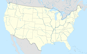
브루클라인 (매사추세츠주)
브루클라인(Brookline)은 노퍽군 (매사추세츠주)의 도시로, 인구는 58,732명이다. 미국 제35대 대통령이었던 존 F 케네디의 고향이기도 하다
| 브루클라인 Brookline | |
|---|---|
 | |
|
| |
| 행정 | |
| 국가 | 미국 |
| 행정 구역 | 매사추세츠주 |
| 역사 | |
| 설립 | 1705년 |
| 지리 | |
| 면적 | 17.7 km2 |
| 시간대 | 동부 표준시(UTC-5) |
| 인문 | |
| 인구 | 58,732명(2010년) |
| 인구 밀도 | 3,318.19명/km2 |
| 지역 부호 | |
| 우편번호 | 02445~02447, 02467 |
| 지역번호 | 617, 857 |
| 웹사이트 | brooklinema.gov |
인구
편집| 연도 | 인구 | ±% |
|---|---|---|
| 1790 | 484 | — |
| 1800 | 605 | +25.0% |
| 1810 | 784 | +29.6% |
| 1820 | 900 | +14.8% |
| 1830 | 1,043 | +15.9% |
| 1840 | 1,365 | +30.9% |
| 1850 | 2,516 | +84.3% |
| 1860 | 5,164 | +105.2% |
| 1870 | 6,650 | +28.8% |
| 1880 | 8,057 | +21.2% |
| 1890 | 12,103 | +50.2% |
| 1900 | 19,935 | +64.7% |
| 1910 | 27,792 | +39.4% |
| 1920 | 37,748 | +35.8% |
| 1930 | 47,491 | +25.8% |
| 1940 | 49,786 | +4.8% |
| 1950 | 57,589 | +15.7% |
| 1960 | 54,044 | −6.2% |
| 1970 | 58,689 | +8.6% |
| 1980 | 55,062 | −6.2% |
| 1990 | 54,718 | −0.6% |
| 2000 | 57,107 | +4.4% |
| 2010 | 58,732 | +2.8% |
| 2018* | 59,310 | +1.0% |
| : * = population estimate. 출처: United States Census records and Population Estimates Program data.[1][2][3][4][5][6][7][8][9][10][11][12] | ||
기후
편집| Brookline, MA의 기후 | |||||||||||||
|---|---|---|---|---|---|---|---|---|---|---|---|---|---|
| 월 | 1월 | 2월 | 3월 | 4월 | 5월 | 6월 | 7월 | 8월 | 9월 | 10월 | 11월 | 12월 | 연간 |
| 역대 최고 기온 °F (°C) | 72.0 (22.2) |
70.0 (21.1) |
89.0 (31.7) |
94.0 (34.4) |
97.0 (36.1) |
100.0 (37.8) |
104.0 (40.0) |
102.0 (38.9) |
102.0 (38.9) |
90.0 (32.2) |
83.0 (28.3) |
76.0 (24.4) |
104.0 (40.0) |
| 일평균 최고 기온 °F (°C) | 36.0 (2.2) |
39.0 (3.9) |
45.0 (7.2) |
56.0 (13.3) |
66.0 (18.9) |
76.0 (24.4) |
82.0 (27.8) |
80.0 (26.7) |
72.0 (22.2) |
61.0 (16.1) |
52.0 (11.1) |
41.0 (5.0) |
58.83 (14.91) |
| 일평균 최저 기온 °F (°C) | 22.0 (−5.6) |
25.0 (−3.9) |
31.0 (−0.6) |
41.0 (5.0) |
50.0 (10.0) |
60.0 (15.6) |
65.0 (18.3) |
65.0 (18.3) |
57.0 (13.9) |
47.0 (8.3) |
38.0 (3.3) |
28.0 (−2.2) |
44.08 (6.71) |
| 역대 최저 기온 °F (°C) | −30.0 (−34.4) |
−18.0 (−27.8) |
−8.0 (−22.2) |
11.0 (−11.7) |
31.0 (−0.6) |
41.0 (5.0) |
50.0 (10.0) |
46.0 (7.8) |
34.0 (1.1) |
25.0 (−3.9) |
−2.0 (−18.9) |
−17.0 (−27.2) |
−30.0 (−34.4) |
| 평균 강수량 인치 (mm) | 3.36 (85) |
3.38 (86) |
4.32 (110) |
3.74 (95) |
3.49 (89) |
3.68 (93) |
3.43 (87) |
3.35 (85) |
3.44 (87) |
3.94 (100) |
3.99 (101) |
3.78 (96) |
43.9 (1,120) |
| 출처: Weather.com[13] | |||||||||||||
같이 보기
편집각주
편집- ↑ “Total Population (P1), 2010 Census Summary File 1”. 《American FactFinder, All County Subdivisions within Massachusetts》. United States Census Bureau. 2010.
- ↑ “Massachusetts by Place and County Subdivision - GCT-T1. Population Estimates”. United States Census Bureau. 2011년 7월 12일에 확인함.
- ↑ “1990 Census of Population, General Population Characteristics: Massachusetts” (PDF). US Census Bureau. December 1990. Table 76: General Characteristics of Persons, Households, and Families: 1990. 1990 CP-1-23. 2011년 7월 12일에 확인함.
- ↑ “1980 Census of the Population, Number of Inhabitants: Massachusetts” (PDF). US Census Bureau. December 1981. Table 4. Populations of County Subdivisions: 1960 to 1980. PC80-1-A23. 2011년 7월 12일에 확인함.
- ↑ “1950 Census of Population” (PDF). Bureau of the Census. 1952. Section 6, Pages 21-10 and 21-11, Massachusetts Table 6. Population of Counties by Minor Civil Divisions: 1930 to 1950. 2011년 7월 12일에 확인함.
- ↑ “1920 Census of Population” (PDF). Bureau of the Census. Number of Inhabitants, by Counties and Minor Civil Divisions. Pages 21-5 through 21-7. Massachusetts Table 2. Population of Counties by Minor Civil Divisions: 1920, 1910, and 1920. 2011년 7월 12일에 확인함.
- ↑ “1890 Census of the Population” (PDF). Department of the Interior, Census Office. Pages 179 through 182. Massachusetts Table 5. Population of States and Territories by Minor Civil Divisions: 1880 and 1890. 2011년 7월 12일에 확인함.
- ↑ “1870 Census of the Population” (PDF). Department of the Interior, Census Office. 1872. Pages 217 through 220. Table IX. Population of Minor Civil Divisions, &c. Massachusetts. 2011년 7월 12일에 확인함.
- ↑ “1860 Census” (PDF). Department of the Interior, Census Office. 1864. Pages 220 through 226. State of Massachusetts Table No. 3. Populations of Cities, Towns, &c. 2011년 7월 12일에 확인함.
- ↑ “1850 Census” (PDF). Department of the Interior, Census Office. 1854. Pages 338 through 393. Populations of Cities, Towns, &c. 2011년 7월 12일에 확인함.
- ↑ “1950 Census of Population” (PDF). 1: Number of Inhabitants. Bureau of the Census. 1952. Section 6, Pages 21–7 through 21-09, Massachusetts Table 4. Population of Urban Places of 10,000 or more from Earliest Census to 1920. 2011년 7월 12일에 확인함.
- ↑ “2010-2012 American Community Surver 3-Year Estimates”. 1: Total Population. American Community Survey. 2012. 2020년 2월 12일에 원본 문서에서 보존된 문서. 2014년 4월 19일에 확인함.
- ↑ “Brookline, MA Weather Data”. Open Publishing. 2009. 2014년 2월 21일에 확인함.
외부 링크
편집- 위키미디어 공용에 브루클라인 관련 미디어 분류가 있습니다.
| 이 글은 미국에 관한 토막글입니다. 여러분의 지식으로 알차게 문서를 완성해 갑시다. |
