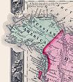
파일:1860-russian-america.jpg

미리 보기 크기: 528 × 599 픽셀 다른 해상도: 211 × 240 픽셀 | 423 × 480 픽셀 | 732 × 831 픽셀
원본 파일 (732 × 831 픽셀, 파일 크기: 198 KB, MIME 종류: image/jpeg)
파일 역사
날짜/시간 링크를 클릭하면 해당 시간의 파일을 볼 수 있습니다.
| 날짜/시간 | 섬네일 | 크기 | 사용자 | 설명 | |
|---|---|---|---|---|---|
| 현재 | 2007년 3월 14일 (수) 00:25 |  | 732 × 831 (198 KB) | Angusmclellan | {{Information |Description=In this 1860 map, Russian America (Alaska) was to the west of British America (Canada). Excerpt from the "Map of North America. Showing its Political Divisions, and Recent Discoveries in the Polar Regions" in Mitchell's New Gen |
이 파일을 사용하는 문서
다음 문서 1개가 이 파일을 사용하고 있습니다:
이 파일을 사용하고 있는 모든 위키의 문서 목록
다음 위키에서 이 파일을 사용하고 있습니다:
- af.wiki.x.io에서 이 파일을 사용하고 있는 문서 목록
- ar.wiki.x.io에서 이 파일을 사용하고 있는 문서 목록
- az.wiki.x.io에서 이 파일을 사용하고 있는 문서 목록
- bg.wiki.x.io에서 이 파일을 사용하고 있는 문서 목록
- ca.wiki.x.io에서 이 파일을 사용하고 있는 문서 목록
- cs.wiki.x.io에서 이 파일을 사용하고 있는 문서 목록
- da.wiki.x.io에서 이 파일을 사용하고 있는 문서 목록
- de.wiki.x.io에서 이 파일을 사용하고 있는 문서 목록
- el.wiki.x.io에서 이 파일을 사용하고 있는 문서 목록
- en.wiki.x.io에서 이 파일을 사용하고 있는 문서 목록
- eo.wiki.x.io에서 이 파일을 사용하고 있는 문서 목록
- es.wiki.x.io에서 이 파일을 사용하고 있는 문서 목록
- et.wiki.x.io에서 이 파일을 사용하고 있는 문서 목록
- eu.wiki.x.io에서 이 파일을 사용하고 있는 문서 목록
- fa.wiki.x.io에서 이 파일을 사용하고 있는 문서 목록
- fi.wiki.x.io에서 이 파일을 사용하고 있는 문서 목록
- frr.wiki.x.io에서 이 파일을 사용하고 있는 문서 목록
- fr.wiki.x.io에서 이 파일을 사용하고 있는 문서 목록
- fr.wiktionary.org에서 이 파일을 사용하고 있는 문서 목록
- fy.wiki.x.io에서 이 파일을 사용하고 있는 문서 목록
- he.wiki.x.io에서 이 파일을 사용하고 있는 문서 목록
이 파일의 더 많은 사용 내역을 봅니다.


