파일:BlankMap-World-alt.svg

원본 파일 (SVG 파일, 실제 크기 1,500 × 775 픽셀, 파일 크기: 194 KB)
파일 설명
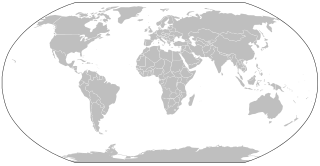
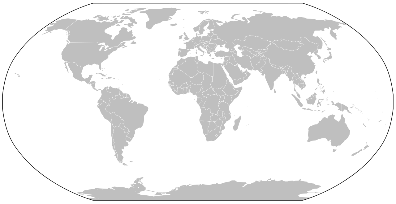
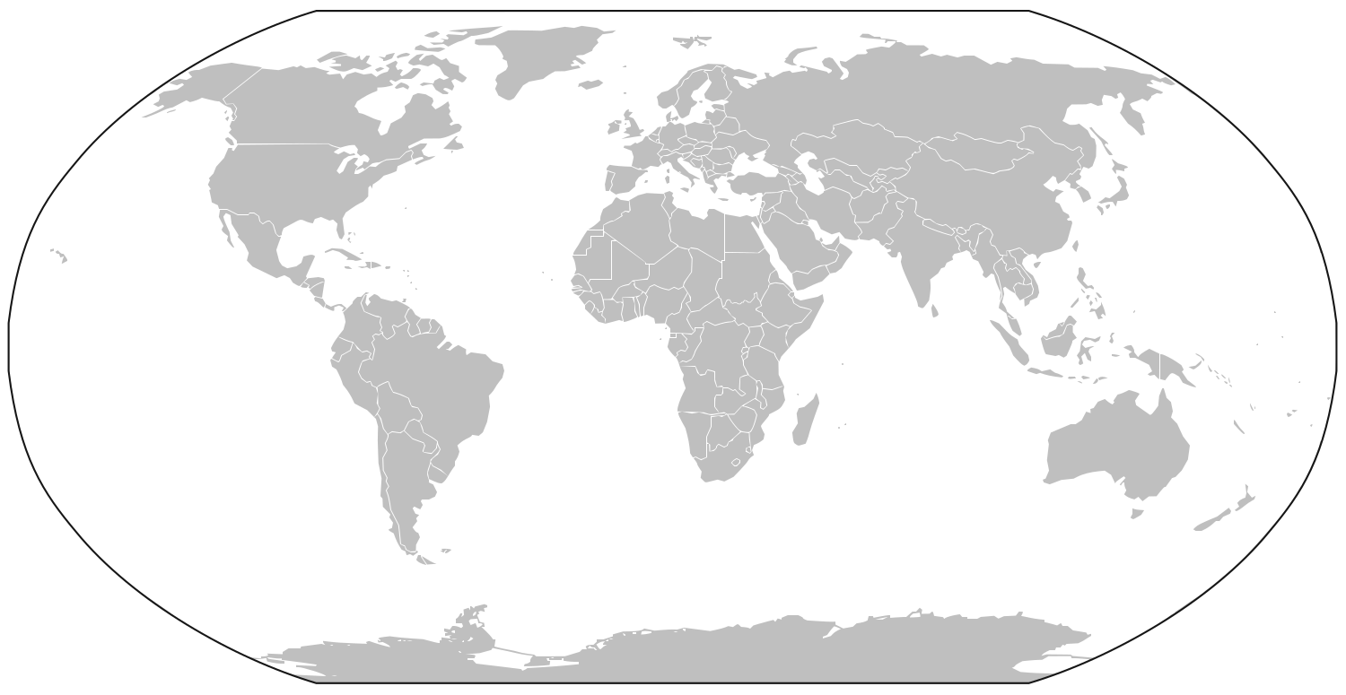
A map of the world as of 2005, with country outlines, for making country locator maps. Similar to Image:BlankMap-World.png with additions of the projection periphery and rendition of Antarctica, et al., this map uses the Robinson projection centered on the Greenwich Prime Meridian and includes various en:microstates/en:island nations. All territories indicated in the UN listing of territories and regions are exhibited.
The map was made by User:Vardion; adapted by User:E Pluribus Anthony and User:QuartierLatin1968 for Wikipedia.
Converted to SVG format by User:Sbrools using en:Inkscape.
라이선스
| 이 작품은 저작자인 Vardion에 의해 퍼블릭 도메인으로 공개된 작품입니다. 이 공개 선언은 전 세계적으로 유효합니다. 만약 저작권의 포기가 법률적으로 가능하지 않은 경우, |
derivative works
이 파일은 다음으로 파생됨: Mesonychoteuthis map.svg
파일 역사
날짜/시간 링크를 클릭하면 해당 시간의 파일을 볼 수 있습니다.
| 날짜/시간 | 섬네일 | 크기 | 사용자 | 설명 | |
|---|---|---|---|---|---|
| 현재 | 2016년 10월 4일 (화) 04:59 | | 1,500 × 775 (194 KB) | BurritoBazooka | Borders of Lesotho were not marked. Why are the borders so low fidelity? You can barely recognise the Balkans. |
| 2014년 2월 5일 (수) 02:58 |  | 1,500 × 775 (191 KB) | AnonMoos | impose clipping path | |
| 2014년 2월 4일 (화) 20:04 |  | 1,500 × 775 (191 KB) | AnonMoos | folding in the improvements from my previously-uploaded versions, keeping Goran tek-en's South Sudan borders... | |
| 2014년 2월 4일 (화) 03:30 |  | 1,500 × 775 (202 KB) | Goran tek-en | Added South Soudan | |
| 2014년 2월 1일 (토) 08:42 |  | 1,500 × 775 (224 KB) | AnonMoos | clean up frame | |
| 2014년 1월 31일 (금) 18:24 |  | 1,500 × 775 (245 KB) | AnonMoos | outside the black line made transparent | |
| 2007년 2월 22일 (목) 11:20 |  | 1,500 × 775 (238 KB) | Sbrools | == Summary == A blank map of the world as of 2005, with country outlines, for making country locator maps. Similar to Image:BlankMap-World.png with additions of the projection periphery and rendition of Antarctica, et al., this map uses the [[:en:Ro |
이 파일을 사용하는 문서
다음 문서 6개가 이 파일을 사용하고 있습니다:
이 파일을 사용하고 있는 모든 위키의 문서 목록
다음 위키에서 이 파일을 사용하고 있습니다:
- de.wiktionary.org에서 이 파일을 사용하고 있는 문서 목록