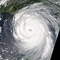
파일:Hurricane Katrina August 28 2005 NASA.jpg

미리 보기 크기: 465 × 600 픽셀 다른 해상도: 186 × 240 픽셀 | 372 × 480 픽셀 | 595 × 768 픽셀 | 793 × 1,024 픽셀 | 1,587 × 2,048 픽셀 | 6,200 × 8,000 픽셀
원본 파일 (6,200 × 8,000 픽셀, 파일 크기: 9.5 MB, MIME 종류: image/jpeg)
파일 역사
날짜/시간 링크를 클릭하면 해당 시간의 파일을 볼 수 있습니다.
| 날짜/시간 | 섬네일 | 크기 | 사용자 | 설명 | |
|---|---|---|---|---|---|
| 현재 | 2021년 4월 19일 (월) 06:21 |  | 6,200 × 8,000 (9.5 MB) | FleurDeOdile | Reverted to version as of 21:42, 18 October 2010 (UTC) how dare you do that to an iconic picture |
| 2021년 4월 18일 (일) 04:42 |  | 3,250 × 4,076 (2.02 MB) | Pilas24 | Straightened | |
| 2010년 10월 19일 (화) 06:42 |  | 6,200 × 8,000 (9.5 MB) | Potapych | moved picture to new location File:Hurricane Katrina August 28 2005 cropped.jpg | |
| 2010년 9월 30일 (목) 09:43 |  | 5,000 × 5,000 (5.45 MB) | HurricaneSpin | Reverted to version as of 05:28, 18 September 2010 | |
| 2010년 9월 19일 (일) 02:17 |  | 6,200 × 8,000 (9.5 MB) | Potapych | Upload it as a new file, please. The other one has a black bar in the corner and very little left of the scene | |
| 2010년 9월 18일 (토) 14:28 |  | 5,000 × 5,000 (5.45 MB) | HurricaneSpin | It's always better to have image facing north | |
| 2010년 9월 18일 (토) 12:19 |  | 6,200 × 8,000 (9.5 MB) | Potapych | Reverted to version as of 16:42, 26 August 2006 This one is far superior to all the subsequent versions | |
| 2010년 9월 18일 (토) 03:50 |  | 5,000 × 5,000 (5.45 MB) | HurricaneSpin | Cropped little bit more. | |
| 2010년 9월 18일 (토) 03:16 |  | 6,500 × 7,000 (10.18 MB) | HurricaneSpin | North orientation and cropped. | |
| 2008년 10월 8일 (수) 07:32 |  | 6,200 × 8,000 (9.5 MB) | Infrogmation | Reverted to version as of 16:42, 26 August 2006 |
이 파일을 사용하는 문서
다음 문서 6개가 이 파일을 사용하고 있습니다:
이 파일을 사용하고 있는 모든 위키의 문서 목록
다음 위키에서 이 파일을 사용하고 있습니다:
- af.wiki.x.io에서 이 파일을 사용하고 있는 문서 목록
- ar.wiki.x.io에서 이 파일을 사용하고 있는 문서 목록
- bg.wiki.x.io에서 이 파일을 사용하고 있는 문서 목록
- bn.wikivoyage.org에서 이 파일을 사용하고 있는 문서 목록
- ca.wiki.x.io에서 이 파일을 사용하고 있는 문서 목록
- ckb.wiki.x.io에서 이 파일을 사용하고 있는 문서 목록
- cs.wiki.x.io에서 이 파일을 사용하고 있는 문서 목록
- cy.wiki.x.io에서 이 파일을 사용하고 있는 문서 목록
- da.wiki.x.io에서 이 파일을 사용하고 있는 문서 목록
- de.wiki.x.io에서 이 파일을 사용하고 있는 문서 목록
- de.wikiversity.org에서 이 파일을 사용하고 있는 문서 목록
- de.wiktionary.org에서 이 파일을 사용하고 있는 문서 목록
- el.wiki.x.io에서 이 파일을 사용하고 있는 문서 목록
- en.wiki.x.io에서 이 파일을 사용하고 있는 문서 목록
- Wikipedia:Today's featured article/September 29, 2006
- User:Jdorje/2005 Atlantic hurricane season/2005 Atlantic hurricane season storms
- Wikipedia:Today's featured article/September 2006
- User:Nauticashades/FPC
- Talk:Hurricane Katrina/Archive 6
- Wikipedia:Featured picture candidates/October-2006
- Wikipedia:Featured picture candidates/Hurricane Katrina
- User:KrakatoaKatie/CalendarAugust
- Wikipedia:Featured picture candidates/March-2008
- Wikipedia:Featured picture candidates/Hurricane Katrina August 28 2005 NASA.jpg
- Wikipedia:Graphics Lab/Photography workshop/Archive/Jun 2010
- Wikipedia talk:WikiProject Tropical cyclones/Archive 23
- User:IPhonehurricane95/Picture of the day/Hurricane Katrina
- User:LightandDark2000/My Notable Storms
- User:SuperNascar 1991
- Wikipedia:Top 25 Report/October 2 to 8, 2016
- Wikipedia:Wikipedia Signpost/2017-06-23/Featured content
- Wikipedia:Wikipedia Signpost/Single/2017-06-23
- User:40bus/sandbox1
- User:Junderwoo08/2019 hypothetical hurricane season
- User:The ganymedian/Year 2017 events collage
- Extreme weather post-traumatic stress disorder
- User:Vasquez ariana/Extreme weather post-traumatic stress disorder
이 파일의 더 많은 사용 내역을 봅니다.

