파일:Hurricane Katrina wind swath.gif

원본 파일 (895 × 716 픽셀, 파일 크기: 29 KB, MIME 종류: image/gif)
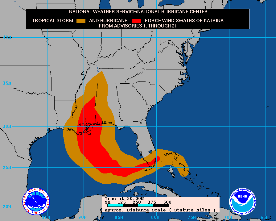
Tropical Storm KATRINA - Cumulative wind distribution
From data release #31 issued 10 AM CDT, 30 August, 2005 by National Hurricane Center Website
파일 설명
The path of Hurricane Katrina, obtained from http://www.nhc.noaa.gov/archive/2005/graphics/AT12/31.AL1205S.GIF
This display shows how the size of the storm has changed, and the areas potentially affected so far by sustained winds of tropical storm force (in orange) and hurricane force (in red). The display is based on the wind radii contained in the set of Forecast/Advisories indicated at the top of the figure. Users are reminded that the Forecast/Advisory wind radii represent the maximum possible extent of a given wind speed within particular quadrants around the tropical cyclone. As a result, not all locations falling within the orange or red swaths will have experienced sustained tropical storm or hurricane force winds, respectively.
라이선스
|
|
파일 역사
날짜/시간 링크를 클릭하면 해당 시간의 파일을 볼 수 있습니다.
| 날짜/시간 | 섬네일 | 크기 | 사용자 | 설명 | |
|---|---|---|---|---|---|
| 현재 | 2005년 9월 4일 (일) 00:14 | | 895 × 716 (29 KB) | Square87~commonswiki |
이 파일을 사용하는 문서
다음 문서 1개가 이 파일을 사용하고 있습니다:
이 파일을 사용하고 있는 모든 위키의 문서 목록
다음 위키에서 이 파일을 사용하고 있습니다:
- af.wiki.x.io에서 이 파일을 사용하고 있는 문서 목록
- de.wiki.x.io에서 이 파일을 사용하고 있는 문서 목록
- en.wiki.x.io에서 이 파일을 사용하고 있는 문서 목록
- en.wikinews.org에서 이 파일을 사용하고 있는 문서 목록
- es.wiki.x.io에서 이 파일을 사용하고 있는 문서 목록
- nl.wiki.x.io에서 이 파일을 사용하고 있는 문서 목록
- uk.wiki.x.io에서 이 파일을 사용하고 있는 문서 목록