파일:Map-of-Ogasawara-islands-ko.png

미리 보기 크기: 760 × 600 픽셀 다른 해상도: 304 × 240 픽셀 | 608 × 480 픽셀 | 1,011 × 798 픽셀
원본 파일 (1,011 × 798 픽셀, 파일 크기: 265 KB, MIME 종류: image/png)
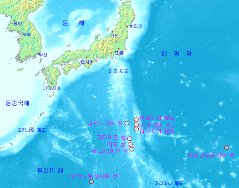
Map of Ogasawara Islands in Korean description. Image source : Image:Map of ogasawara islands.png
This image is in the public domain because it came from the site https://www.demis.nl/products/web-map-server/examples/ and was released by the copyright holder. Permission is granted to copy, distribute and/or modify this map since it is based on free of copyright images from: www.demis.nl. See also approval email on de.wp and its clarification.
|
| This work has been released into the public domain by its copyright holder, www.demis.nl. This applies worldwide. 만약 저작권의 포기가 법률적으로 가능하지 않은 경우, www.demis.nl은 이 작품을 법적으로 허용되는 한도 내에서 누구나 자유롭게 어떤 목적으로도 제한 없이 사용할 수 있도록 허용합니다.
|
파일 역사
날짜/시간 링크를 클릭하면 해당 시간의 파일을 볼 수 있습니다.
| 날짜/시간 | 섬네일 | 크기 | 사용자 | 설명 | |
|---|---|---|---|---|---|
| 현재 | 2006년 5월 12일 (금) 22:21 | | 1,011 × 798 (265 KB) | LERK | Map of Ogasawara Islands in Korean description. Image source : Image:Map of ogasawara islands.png {{demis-pd}} Category:Tokyo Category:Maps of Japan Category:Islands of Japan Category:Maps in Korean |
이 파일을 사용하는 문서
다음 문서 2개가 이 파일을 사용하고 있습니다: