파일:US 68.svg

SVG 파일의 PNG 형식의 미리보기 크기: 600 × 600 픽셀. 다른 해상도: 240 × 240 픽셀 | 480 × 480 픽셀 | 768 × 768 픽셀 | 1,024 × 1,024 픽셀 | 2,048 × 2,048 픽셀
원본 파일 (SVG 파일, 실제 크기 600 × 600 픽셀, 파일 크기: 8 KB)
파일 설명
| 설명 |
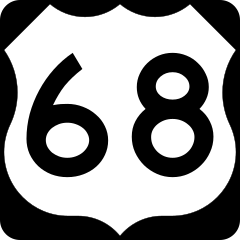
English: 600 mm × 600 mm (24 in × 24 in) U.S. Highway shield, made to the specifications of the 2004 edition of Standard Highway Signs. (Note that there is a missing "J" label on the left side of the diagram.) Uses the Roadgeek 2005 fonts. (United States law does not permit the copyrighting of typeface designs, and the fonts are meant to be copies of a U.S. Government-produced work anyway.) |
| 날짜 | (UTC) |
| 출처 | 2004 MUTCD Standard Highway Signs |
| 저자 | Fredddie, originally SPUI |
라이선스
This file is in the public domain because it comes from the Manual on Uniform Traffic Control Devices, sign number M1-4, which states specifically on page I-1 that:
|
.svg) |
파일 역사
날짜/시간 링크를 클릭하면 해당 시간의 파일을 볼 수 있습니다.
| 날짜/시간 | 섬네일 | 크기 | 사용자 | 설명 | |
|---|---|---|---|---|---|
| 현재 | 2017년 8월 26일 (토) 09:51 | | 600 × 600 (8 KB) | Fredddie | |
| 2006년 1월 27일 (금) 10:51 |  | 600 × 600 (6 KB) | SPUI~commonswiki | {{spuiother}} 600 mm by 600 mm (24 in by 24 in) U.S. Route shield, made to the specifications of the [http://mutcd.fhwa.dot.gov/SHSm/Guide.pdf 2004 edition of Standard Highway Signs]. (Note that there is a missing "J" label on the left side of the diagram |
이 파일을 사용하는 문서
다음 문서 4개가 이 파일을 사용하고 있습니다:
이 파일을 사용하고 있는 모든 위키의 문서 목록
다음 위키에서 이 파일을 사용하고 있습니다:
- ca.wiki.x.io에서 이 파일을 사용하고 있는 문서 목록
- de.wiki.x.io에서 이 파일을 사용하고 있는 문서 목록
- en.wiki.x.io에서 이 파일을 사용하고 있는 문서 목록
- U.S. Route 22
- Interstate 70
- Interstate 75
- Interstate 24
- Interstate 64
- Interstate 65
- Logan County, Ohio
- Hardin County, Ohio
- Greene County, Ohio
- Brown County, Ohio
- Interstate 71
- Boyle County, Kentucky
- List of United States Numbered Highways
- Paducah, Kentucky
- Bowling Green, Kentucky
- North Country Trail
- U.S. Route 27
- U.S. Route 30
- U.S. Route 40
- U.S. Route 50
- U.S. Route 67
- U.S. Route 60
- U.S. Route 69
- U.S. Route 79
- U.S. Route 41
- U.S. Route 52
- U.S. Route 62
- U.S. Route 25
- U.S. Route 33
- U.S. Route 35
- U.S. Route 36
- U.S. Route 42
- U.S. Route 68
- U.S. Route 421
- U.S. Route 231
- U.S. Route 431
- U.S. Route 641
- U.S. Route 150
- U.S. Route 460
- Carl Perkins Bridge
- Ohio State Route 32
- Ohio State Route 53
이 파일의 더 많은 사용 내역을 봅니다.